Seamless Bay Area Integrated Transit Fare Vision Map
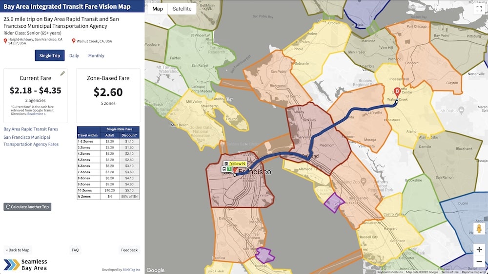
Working with Seamless Bay Area, BlinkTag created an interactive map which demonstrates the vision of an integrated set of fare zones for the entire Bay Area across all 27 transit agencies.
After selecting a specific start and end location, the map calculates the current transit fare and also the fare under an integrated, zone-based fare system. It also compares a single trip, round trip and monthly fares. The calculator can handle complex trips across multiple agencies and routes.
Current fares are fetched from the Google Maps API and come from agency-submitted GTFS data, so they stay up-to-date when fares are changed.
Read more about the integrated fare vision →
© 2007 - 2020 BlnkTag Inc, All rghts reserved.Branding