California Induced Travel Calculator
A simple way to estimate the additional travel associated with highway expansion.

Planners, researchers, and transportation advocates
Research translation · Interactive calculators · Web development

Planners, researchers, and transportation advocates
Research translation · Interactive calculators · Web development
Project overview
The challenge
Widening a highway can make driving easier in the short term, but research shows that added capacity also generates additional driving. A tool was needed to make that long-term effect visible when evaluating proposals to relieve congestion.
Our work
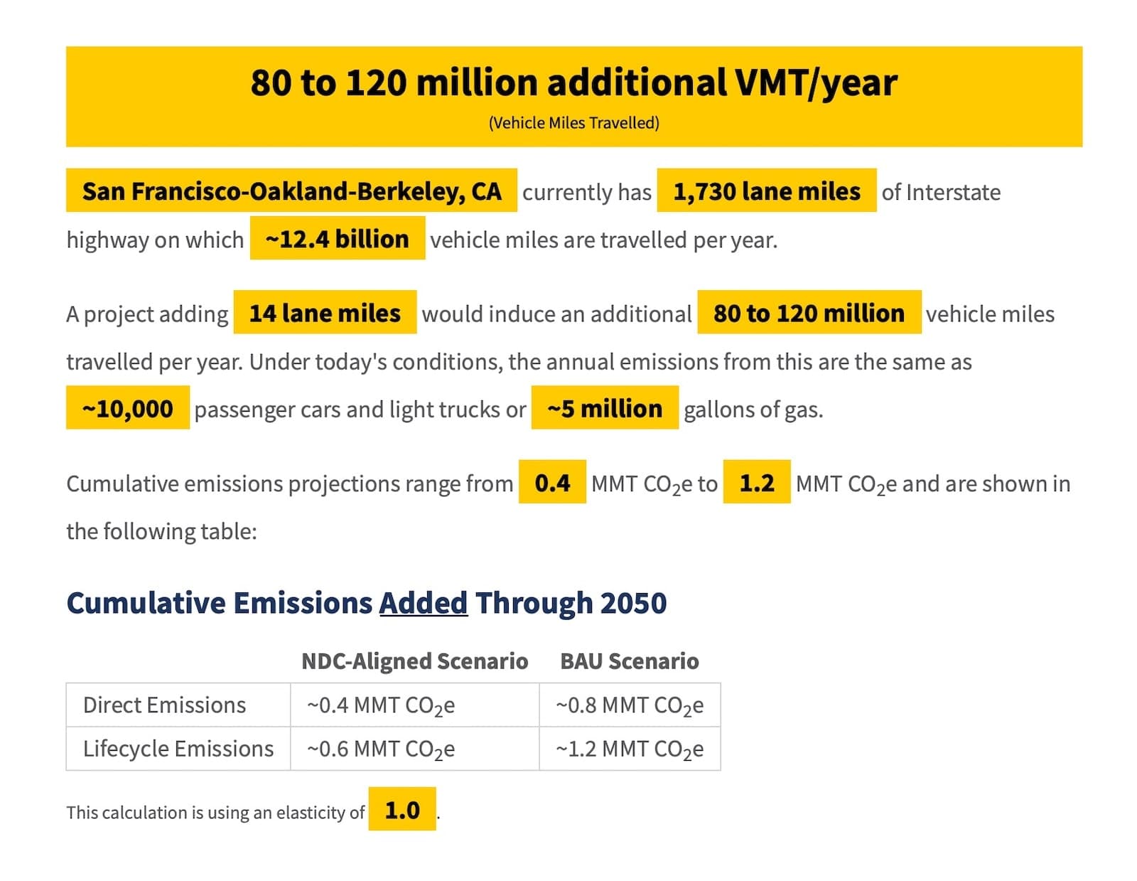
Working with the National Center for Sustainable Transportation (NCST) at UC Davis, we built a calculator that takes a road type, county, and number of added lane-miles, then estimates the associated increase in vehicle miles traveled.
Recommended in Caltrans guidance
Caltrans identifies the NCST calculator as an approach to estimating induced vehicle travel for applicable highway capacity projects. Its guidance uses the calculator directly or to benchmark travel demand model results, depending on the project and analytical approach. The recommendation is subject to the calculator’s geographic and roadway limitations.


Press coverage
The climate-driven push to stop expanding California’s traffic choked freeways hits a roadblock
Colorado’s Bold New Approach to Highways — Not Building Them
Infrastructure plan calls for fixing the nation’s existing roads. Some states are still focused on expansion.
National Center for Sustainable Transportation Explains New Induced Travel Calculator
New Tool Makes it Easy to Estimate Added Travel from New Highway Lanes




Related projects

Planning a similar project?
Tell us about your requirements and the people who will use the system.